Give resident concerns one place to land
A practical guide for municipal staff on bringing scattered non-emergency resident reports into one process, with clear categories, accurate locations, department routing and a visible record of follow-through.
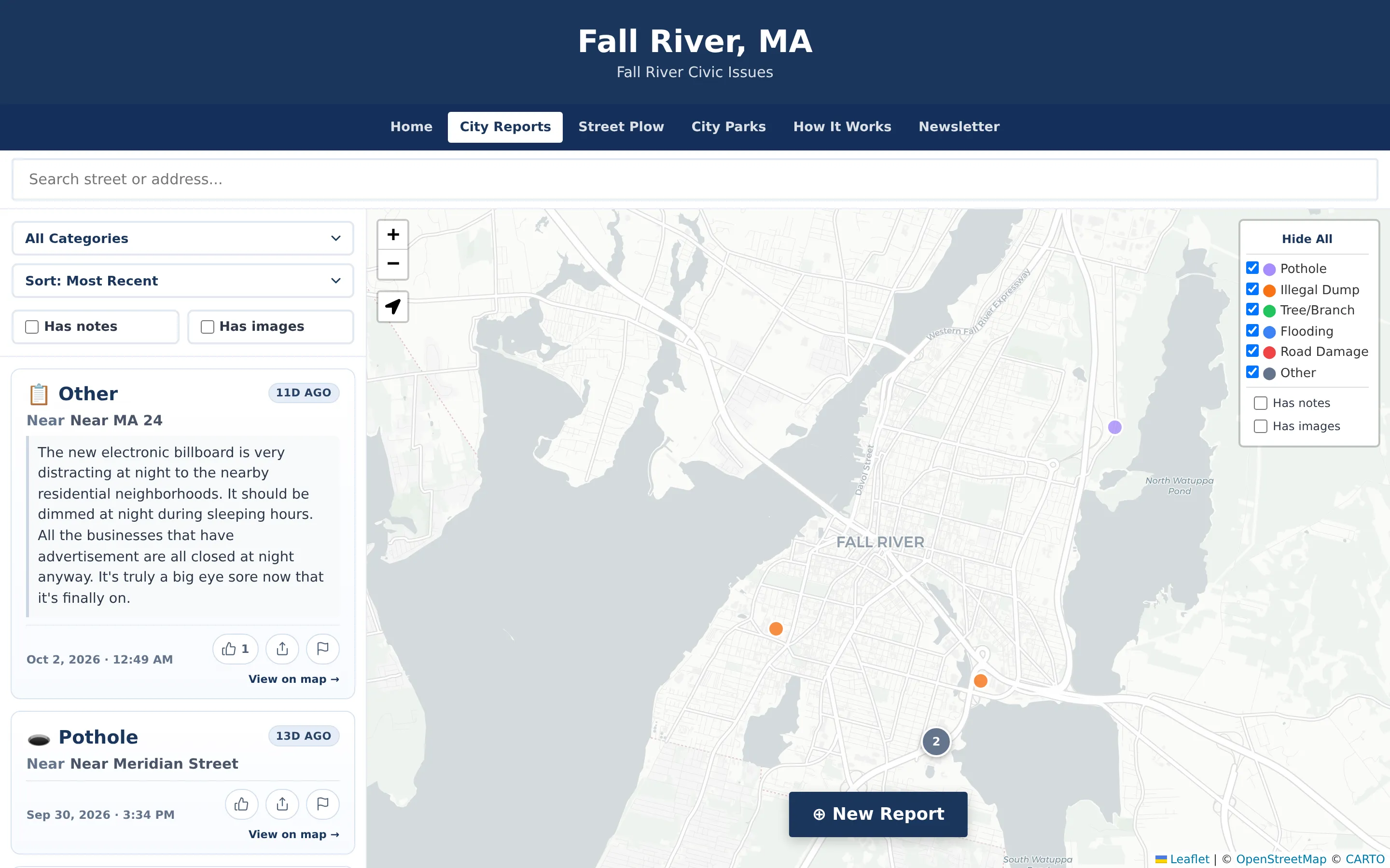
A resident spots a pothole on the way to school drop-off. By lunchtime, that one pothole may have reached the clerk as a phone call, a councilor as an email and a community Facebook group as a post. Someone may also mention it at the next public meeting. Each message lands with a different person, nobody has the full picture, and the resident has no way to know whether anyone received it.
This isn’t a staffing failure. It happens when concerns can come in through any channel and none of those channels was designed for the job. The fix is usually simple: one predictable place where non-emergency issues get reported, sent to the right department and tracked until they’re resolved.
Here are five practical steps to get there, whatever tools you use.
1. Decide what you accept, and say it plainly
Start with a short list of issue categories that match services your departments already provide. Potholes, illegal dumping, trees and branches, flooding and road damage cover a lot of ground. Add an “other” category for everything else. Keep the list short at first and adjust it once you see what residents actually report.
Be just as clear about what doesn’t belong. Non-emergency reporting is not a replacement for 911, and your public guidance should say so wherever residents submit a report.
2. Make the location precise
“The big pothole near the school” is hard to send a crew to. Staff can lose real time just working out where an issue is. Use a map pin, an address search or the resident’s current location so every report arrives with a location crews can act on. An optional photo or short note helps crews know what to expect before they get there.
3. Remove the barriers to reporting
Every extra step costs you reports. If residents have to create an account, download an app or hunt for the right department’s email address, many of them won’t bother. Some will go back to calling whoever they know. A reporting form that works in any phone browser, with no sign-up, makes it easy to report while the details are fresh.
Lowering the barrier also means planning for moderation. Decide up front how notes and photos will be screened before they appear publicly, and who on staff can hide or remove inappropriate content.
4. Route each category to the department responsible
A central inbox helps, but nobody wants to sort every report by hand. Map each category to the department that owns it. Potholes go to Public Works. Illegal dumping might go to Code Enforcement or the Board of Health. Designate who in each department gets notified. Each department then acts on its own reports, and administrators still see one shared record across all of them.
5. Close the loop where residents can see it
Residents report the same problem again and again when they can’t tell that it was already received or fixed. A public map of reported issues helps. So does a clear status and a record of when staff marked something fixed.
It also helps to separate what residents report from what the municipality confirms. Resident reports are useful signals, and a staff-verified outcome is a different kind of information. Showing the two differently lets residents tell them apart.
Keep the record exportable, too. A simple export of reports and outcomes is useful for council updates, grant reports and after-action reviews.
Where CivicReport fits
CivicTally built CivicReport around this process. Residents choose a category, place a pin and can add a short note or photo. They don’t need an account or an app. Each report goes to a staff dashboard, and designated department contacts get an email based on the report’s category. From the dashboard, staff review and moderate content, mark issues fixed, post announcements and export records to CSV. In street-status mode, authorized staff can mark streets “City Verified.” Those streets appear with a distinct badge, so residents can tell confirmed conditions apart from resident votes.
During setup, CivicTally works with your staff to configure categories, routing, notification recipients, map boundaries and public guidance. The product follows how your municipality already works instead of a generic template. CivicReport is for non-emergency issues only, and its public guidance always directs residents to call 911 for emergencies.
You can see a working example at fallriver.civicreport.net. It is an independent community application built on CivicTally software, not an official City of Fall River application.
Start small
You don’t need to change everything at once. Pick a few categories, a couple of departments and one public place to report. Then learn from what comes in. Even a small, consistent process gives residents a clearer path and gives staff a shared record.
See how CivicReport could work for your community. Request a demo →